We laser-scanned the Renzo Barbera: what it took to survey a 50,000 m² stadium
Some projects, while you're working on them, you already know they'll stay with you. The laser scanning survey of Stadio Renzo Barbera in Palermo — commissioned by Palermo FC — was one of them.
Not so much because of the scale, even though the numbers alone would be enough to tell a story: 50,705 m² surveyed, 1,871 scans, nearly 8 billion points acquired. But because this was a public infrastructure, loaded with history, with a complex geometry, and a client that needed more than an updated floor plan — they needed a reliable digital base to build on, quite literally, future decisions.
Check out the dedicated project page in the works section.
The survey started on 7 December 2023. The DEAL team worked on site for weeks, covering the interior and exterior of the structure using a combination of a BLK360 laser scanner and a DJI Phantom 4 Pro drone.
The choice to combine the two technologies was deliberate. The laser scanner, mounted on a 6-metre Manfrotto tripod to ensure coverage and stability, captured the internal and external envelope with millimetric precision — stands, steel structures, staircases, technical rooms. The drone complemented the survey with an orthophoto of the stadium that would have been impossible to obtain from ground level. For georeferencing, we used a Stonex S700a GNSS receiver, coordinated across 6 constellations with aRTK technology, which allows correction even without a continuous signal.
The Leica BLK360 works on the Time of Flight principle — as we described in another Journal article — emitting laser pulses and calculating distances based on their return time. The result is a point cloud acquired at around 360,000 points per second, with an error of 6 mm every 10 metres. Precise numbers, not marginal ones — especially when the stadium you're working on is about to become the subject of a significant renovation.
Nearly 8 billion points, joined into a coherent model.
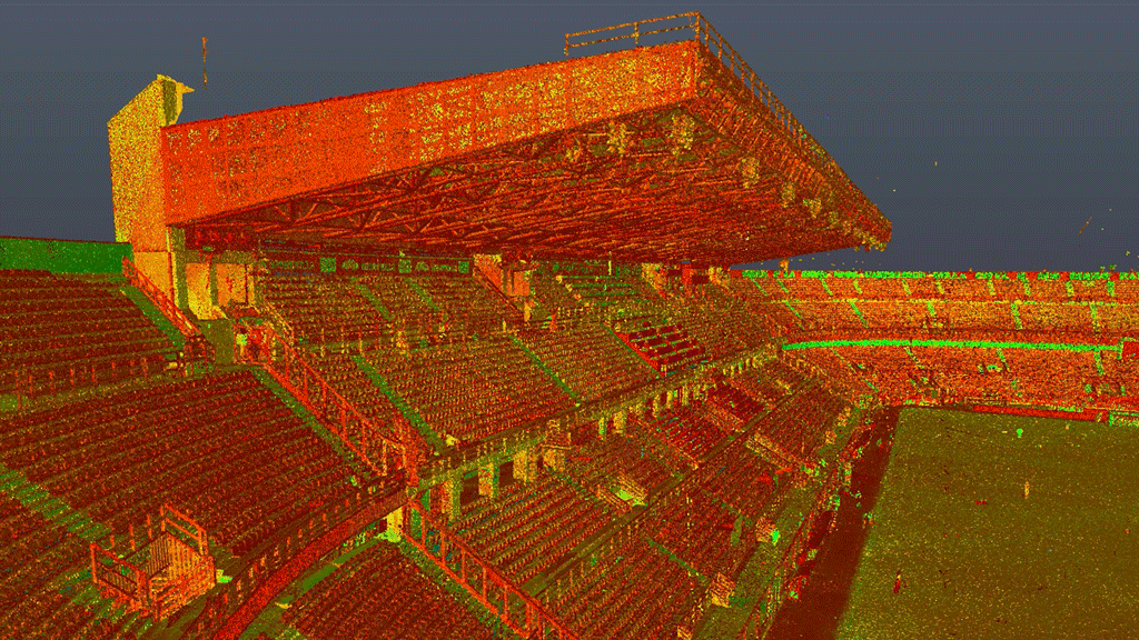
Processing is the phase that usually gets the least attention, but it's arguably where the most rigorous work happens. The 1,871 scans were registered using 2,716 links, building a rigid network that keeps cumulative error to a minimum. The final result is a point cloud of 7,864,716,934 points with a cloud-to-cloud error of 6 millimetres.
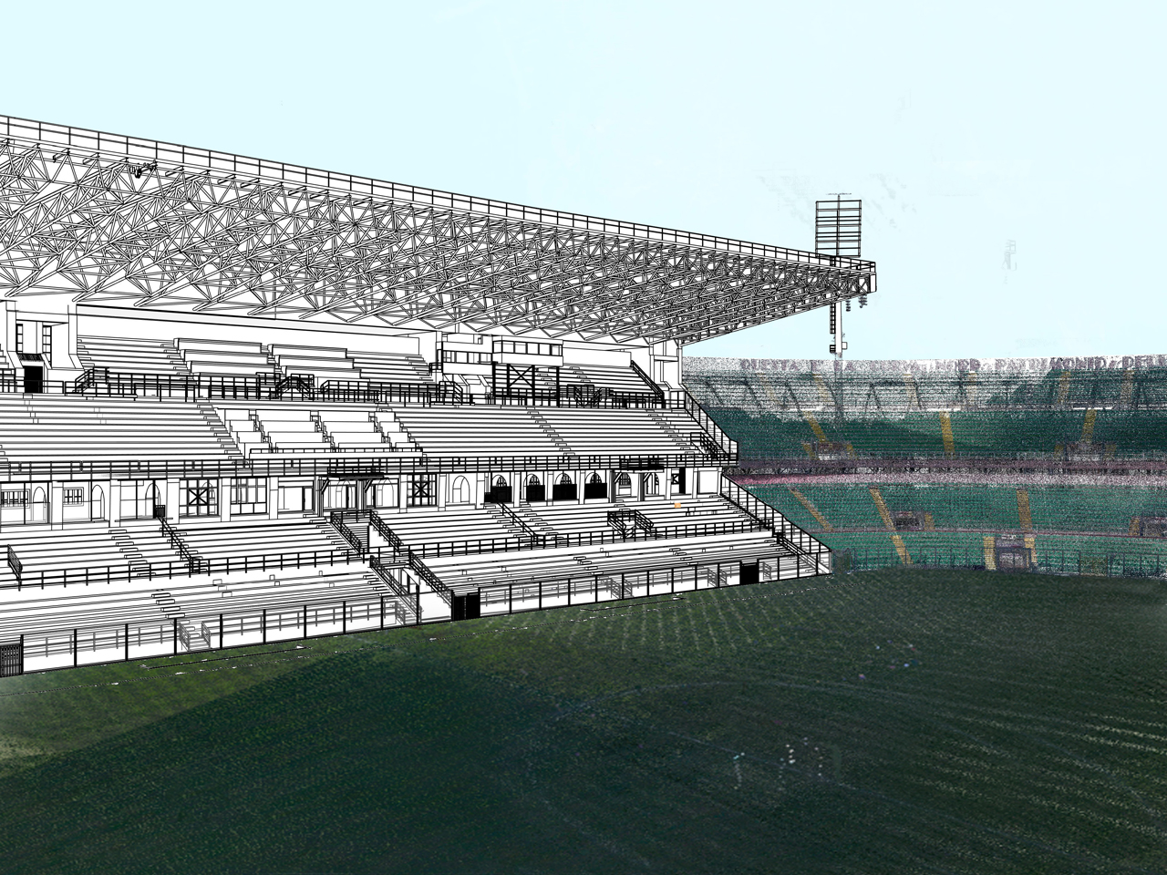
From this point cloud, we modelled the as-built state of the entire stadium in Revit — six floor plans from +2.00 m up to +25.60 m, plus transverse and longitudinal sections. The model includes the iconic Tribuna Monte Pellegrino, Curva Nord and Curva Sud — each with its own sectors, access points and geometry.
Why building a BIM model of an existing stadium makes a lot of sense
There's a question that anyone outside the industry might reasonably ask, and it's worth addressing directly: why invest in such an accurate survey of a building that already exists?
The answer is less obvious than it seems. Anyone who needs to work on an infrastructure like the Renzo Barbera — whether for a partial renovation, a regulatory upgrade or a redesign of internal spaces — needs to know exactly what's there. Not an estimate, not a drawing from twenty years ago, but the actual geometry, with its imperfections, structural deformations and the kind of details no manual method could reliably capture.
A BIM model derived from laser scanning is a verifiable base from which to design with real data, reduce unforeseen variations during construction, and coordinate precisely across disciplines. In short, an upfront investment that reduces the costs you'd otherwise face down the line. In the case of the Renzo Barbera, the model delivered to Palermo FC is exactly that — a solid starting point for any future decision concerning the stadium.
For us, it was also a confirmation of something we know but that's always good to experience firsthand: that the combination of laser scanner and drone, used with method, can capture structures of this scale with a precision that would have been unthinkable just a few years ago.