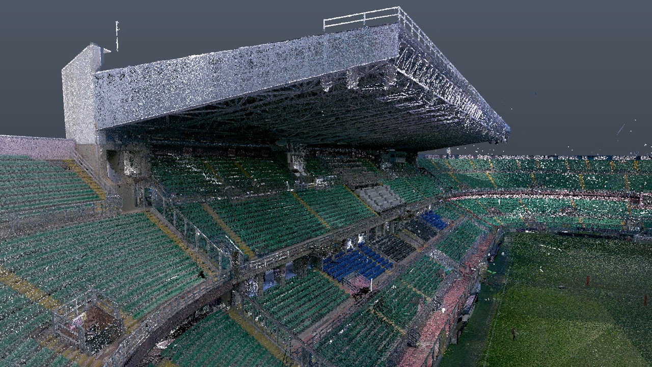
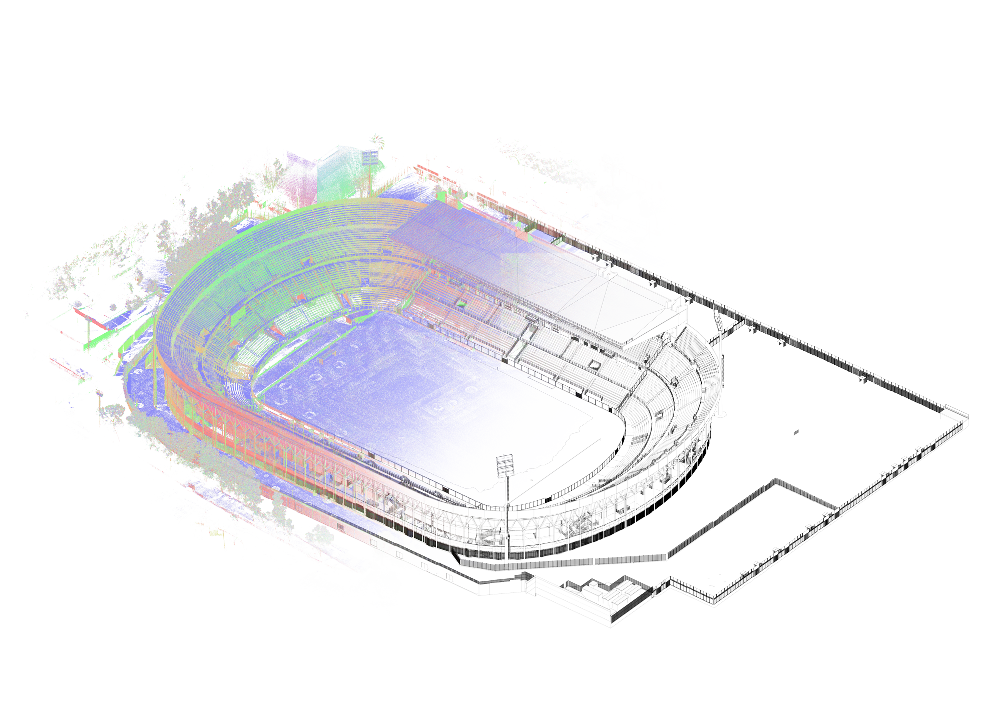
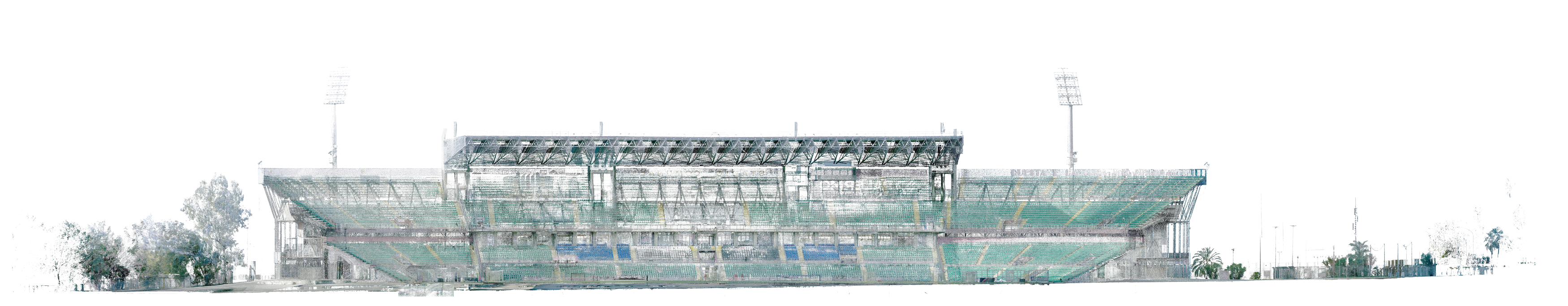
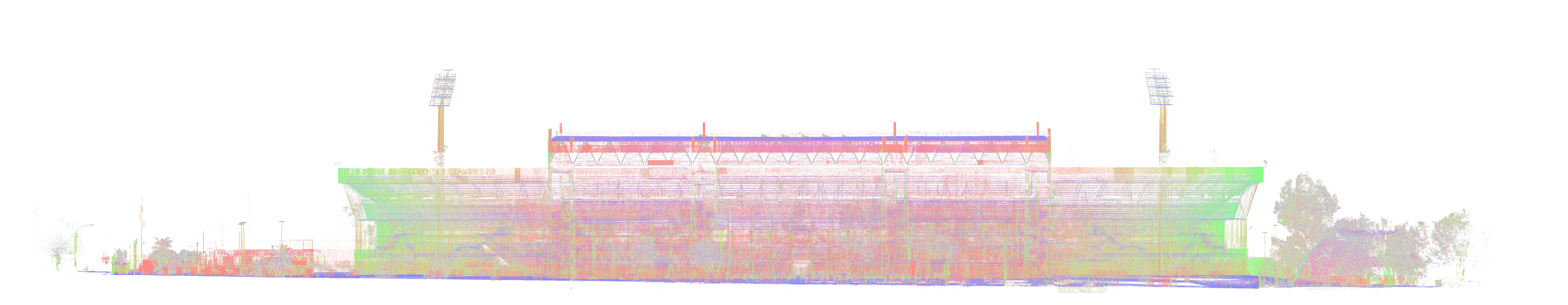
The primary objective of the survey process for the BIM model of Stadio Renzo Barbera in Palermo was to acquire detailed and accurate data in order to deliver a reliable 3D model reflecting the as-built condition of the structure.
Location
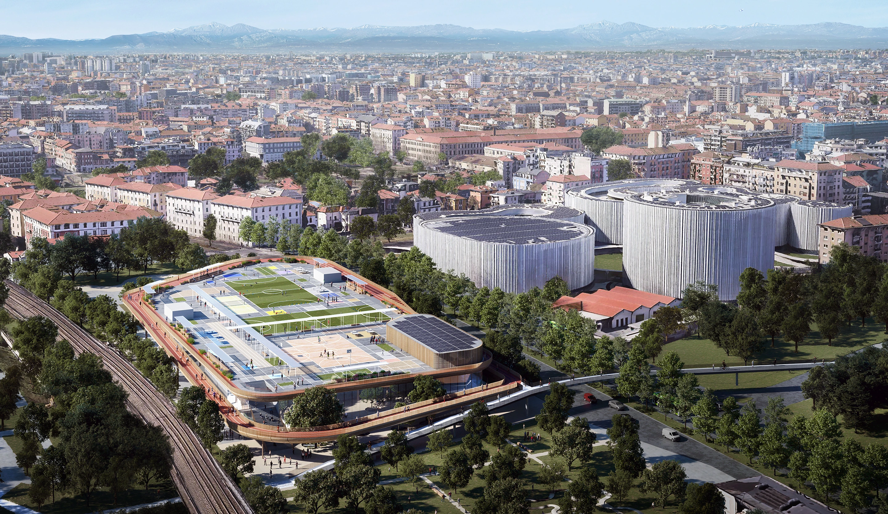
Palermo, ItalyYear
2024Client
Palermo FCTeam
Giuseppe Prestianni, Carlo lannino, Michael Graceffa, Pietro Puleo, Chiara GenovaServices
laser scanner, Drone, Blk 360, Leica
The survey operations were carried out across multiple sessions covering the entire stadium, specifically between 07.12.2023 and 20.01.2024.
The work was carried out using a high-precision Leica BLK360 laser scanner, positioned both inside and outside the structure. The combination of laser scanner and drone proved essential for this project: the drone was used to obtain an orthophoto of the stadium, while the laser scanner allowed for accurate and detailed capture of both internal and external spaces.
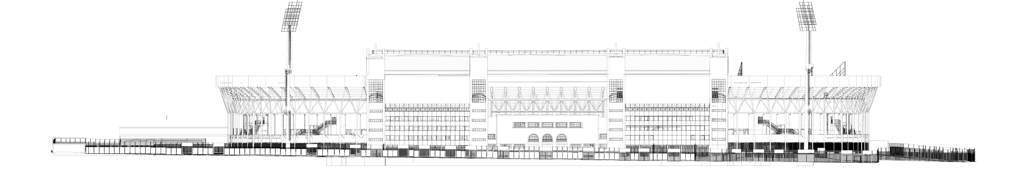
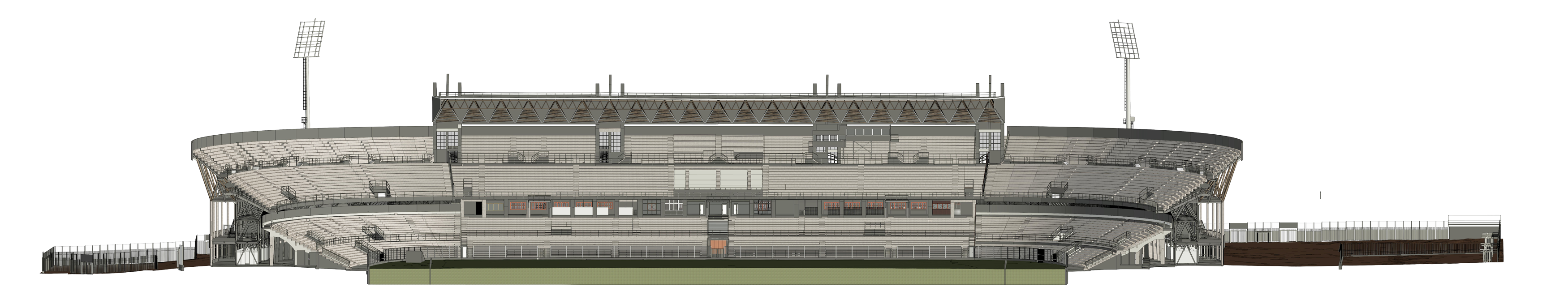
All of the above was essential for the overall data acquisition, aimed at producing the following outputs in 2D vector format DXF/DWG.
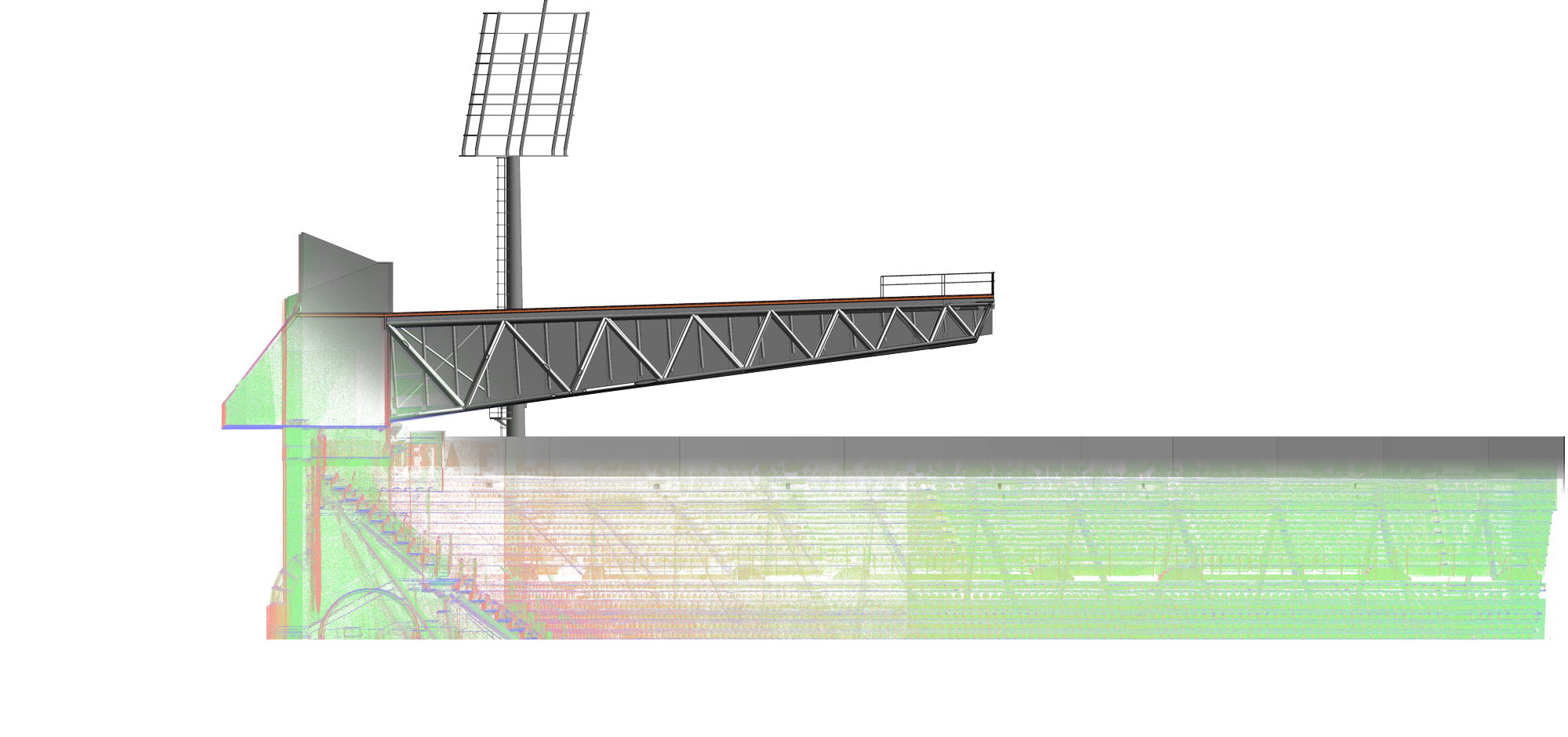
The acquired data was processed to generate a high-resolution point cloud faithfully representing the geometry of the stadium, enabling the creation of a complete and accurate BIM model of the structure. Given the nature of the survey and the use of latest-generation technology, we consider the final deliverable to be of excellent quality and characterised by a very high level of precision. The level of detail provides a solid and reliable foundation for any future design and facility management decisions relating to the stadium.