When practice meets theory: DEAL brings UniPa' students on site with the laser scanner
During a recent site visit to a historic farmhouse – a project still underway whose details we'll reveal soon – Michael and Giuseppe, along with Chiara, Carlo, and Pietro from the DEAL team, worked side by side with students from the "Progetto di recupero e conservazione degli edifici" workshop led by Professor Campisi at the Università degli Studi di Palermo.
During a recent site visit to a historic farmhouse – a project still underway whose details we'll reveal soon – Michael and Giuseppe, along with Chiara, Carlo, and Pietro from the DEAL team, worked side by side with students from the "Progetto di recupero e conservazione degli edifici" workshop led by Professor Campisi at the Università degli Studi di Palermo.
We were invited by Eng. D'amore, a PhD candidate at the university who just finished a book on “Masserie” (a typical south Italy farmhouse) – coming out in a few weeks. The idea was simple: show students how advanced digital surveying actually works, not from textbooks but out in the field.
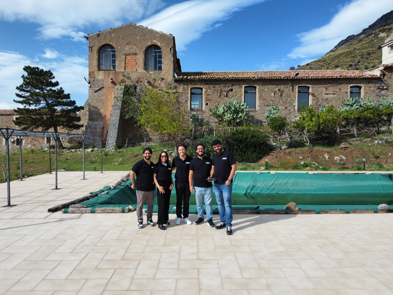
Part of the DEAL team during the site visit and training day with the Università degli Studi di Palermo
The traditional way works. Until it doesn't.
Traditional surveying – the tape measure and flexometer approach – is solid for apartments and small renovations. You learn it, you use it. But when you're facing a complex farmhouse with irregular vaults, bulging walls, and pipes in unexpected places, everything changes.
"Old methods work fine for simpler projects, but with masserie, stadiums, hospitals – these more complex structures – surveying has evolved. That's where the laser scanner comes in," Michael told the students at the start of the demo.
How the laser scanner actually works
The demonstration was straightforward. The laser scanner – in this case the RTC – sends light rays and knows their direction and speed. It measures how long they take to bounce back, calculates the exact distance, and plots a point in 3D space. This happens about 2 million times per second.
You get a "point cloud" – millions of X, Y, Z coordinates that recreate the structure faithfully.
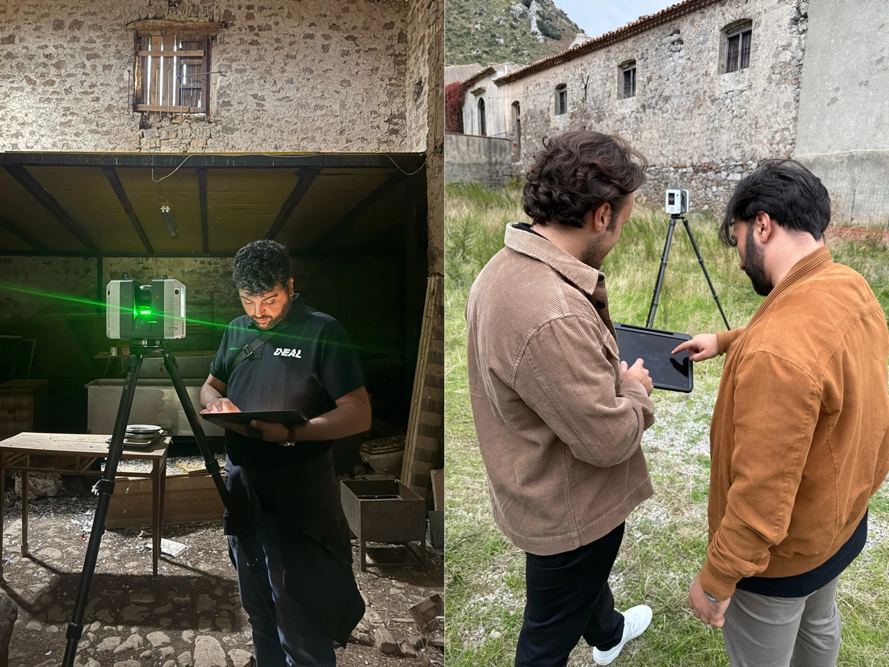
Giuseppe, Pietro and Carlo running laser scanner surveys and processing the data
During the demo, a single scan captured things that would've been a nightmare to measure traditionally: a pipe running high on the ceiling, an unreachable window, the millimeter details of the vaults. Everything in one go.
The students were particularly struck by the virtual tour feature. Each scan creates a 360-degree image that, loaded into software like Leica's, lets you step back into the space from your office computer.
"Say you've done the survey, you're back at the studio, and you realize you're missing a measurement," Michael explained. "With a scan like this, you grab it straight from your computer. No second site visit needed." One trip. Done.
From point cloud to model – and decay mapping for restoration
But the point cloud is just the starting point, Giuseppe added. It's the foundation for "Scan to BIM" – we've covered that in depth elsewhere. The laser scanner data (plus drone footage when you need the exterior) gets processed into a complete 3D model. Ready for Revit or whatever comes next.
"We go straight from preliminary phase to detailed design drawings, already with everything measured to the millimeter," Giuseppe said. For the farmhouse, 4-5 scans would've been enough to capture the whole building. On bigger projects – the Renzo Barbera stadium, a 60-hectare resort – DEAL's done 2,000 to 3,000 scans.
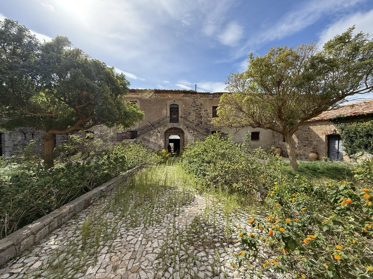
One of the Masseria' interior courtyards
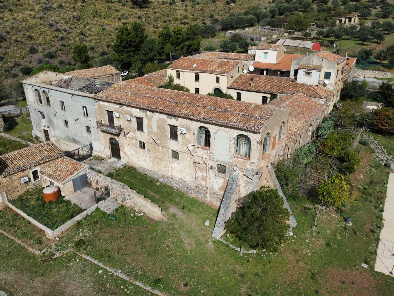
The Masseria complex captured by our drone
But it's not just about speed. The laser scanner is also crucial for restoration work. The professor had spotted a bulge in the farmhouse façade – "the laser shows you the exact curvature," Michael explained. "You work directly on the masonry, map the bulges, the moisture damage, everything. Complete decay analysis."
Inspiration goes both ways
At the end, the students saw the point cloud they'd just captured in real time, navigated through it, watched every element of the farmhouse already digitized and ready to work with back in the studio. Not a lecture. A real job site – professionals using these tools daily on one side, students hungry to learn the craft on the other.
Days like this remind us why we do this. Sharing not just technique but the approach and care behind digital surveying – it matters more than any single project. And it proves that digital tools in service of architecture aren't a luxury. They're necessary for anyone who wants to design with precision and real understanding.