Digital surveying in construction - applications, uses and potential for buildings and territories
Digitalization in the construction sector is steadily gaining ground. Regulations that incentivize BIM adoption and the increasing complexity of projects are pushing many professionals to consider technologies like laser scanners and drones for building surveying.
These tools offer concrete advantages in terms of precision and data completeness, requiring investments and specific skills that are becoming increasingly accessible.
What is digital surveying?
Digital surveying systematically acquires the geometric and spatial characteristics of buildings, terrains and infrastructures, translating them into digital format with precision that can reach the millimeter. The result is "as-built" documentation that is significantly more detailed, accurate and reliable compared to traditional methods based on manual measurements and two-dimensional representations.
For new construction projects, it provides extremely precise reference points to verify alignments, qualitative execution control and compliance with design specifications during all construction phases. For existing buildings destined for renovation, restoration or redevelopment interventions, it systematically and comprehensively documents materials, construction systems, structural typologies, any degradation or structural problems, and all modifications and stratifications that have occurred over time. This information is fundamental for planning effective interventions, accurately estimating costs and timeframes, and avoiding surprises during work execution.
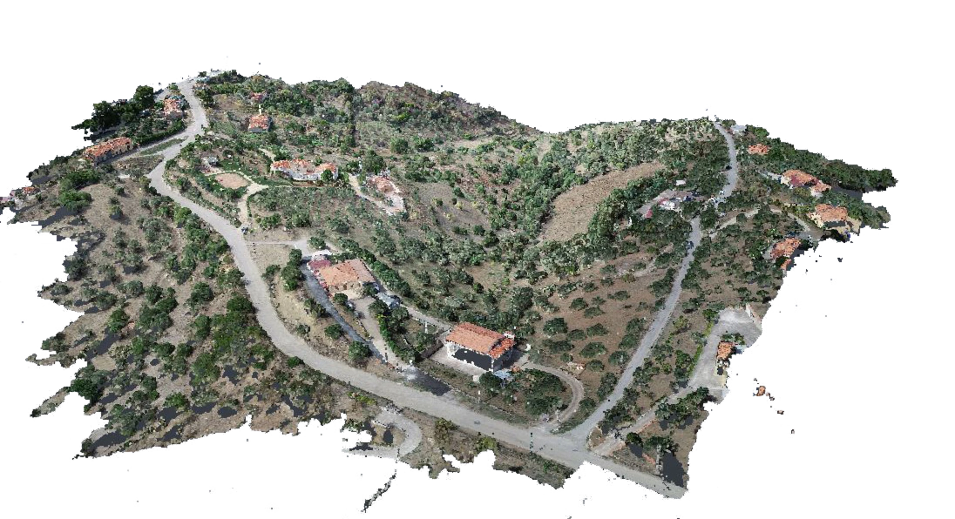
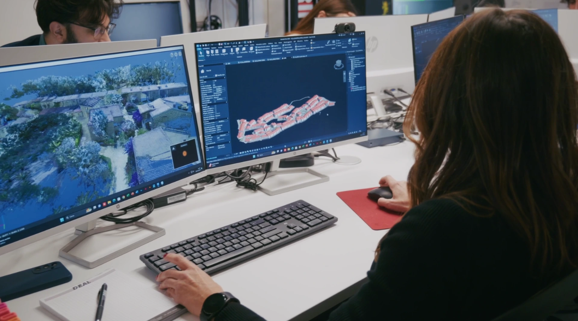
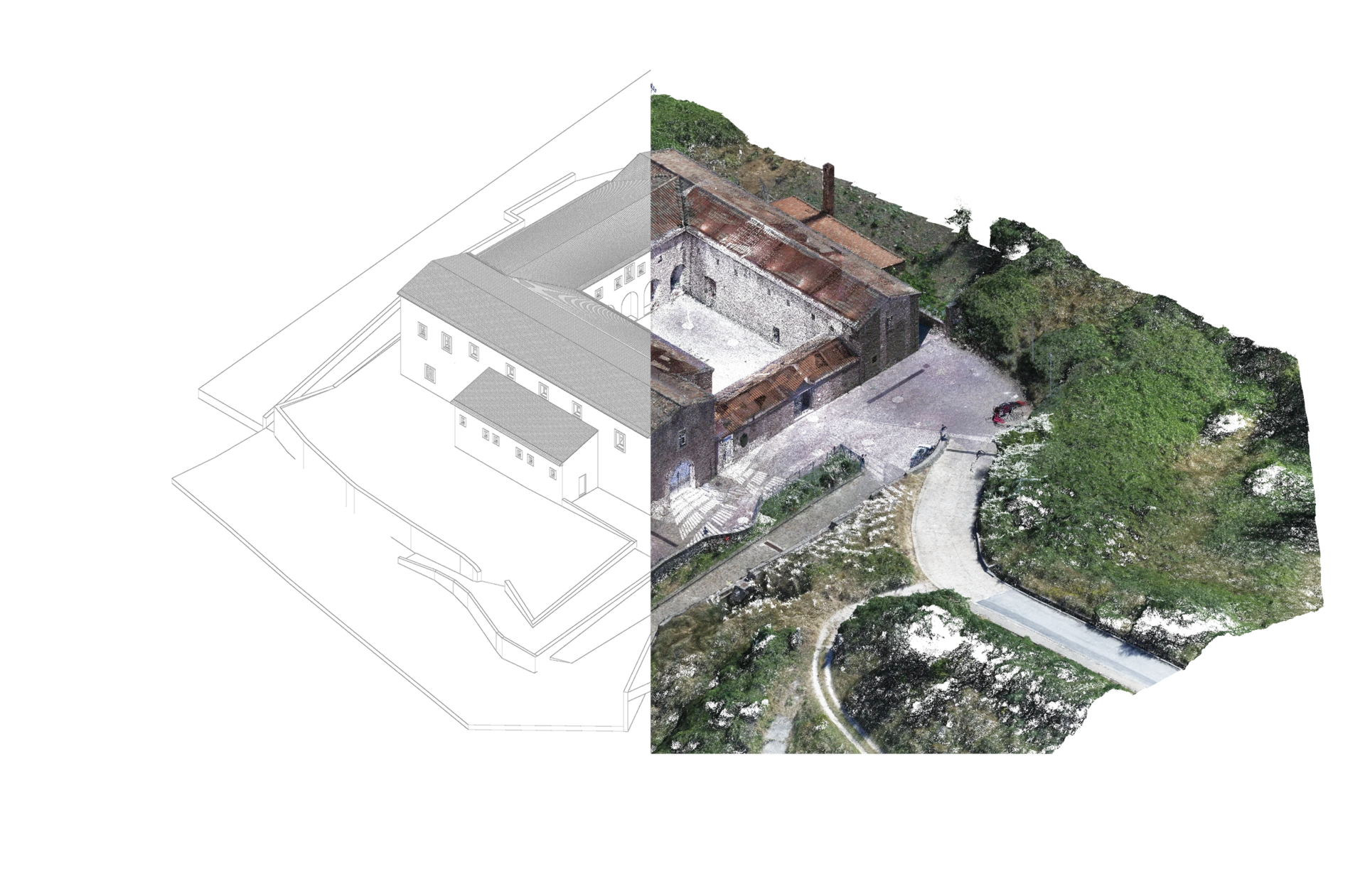
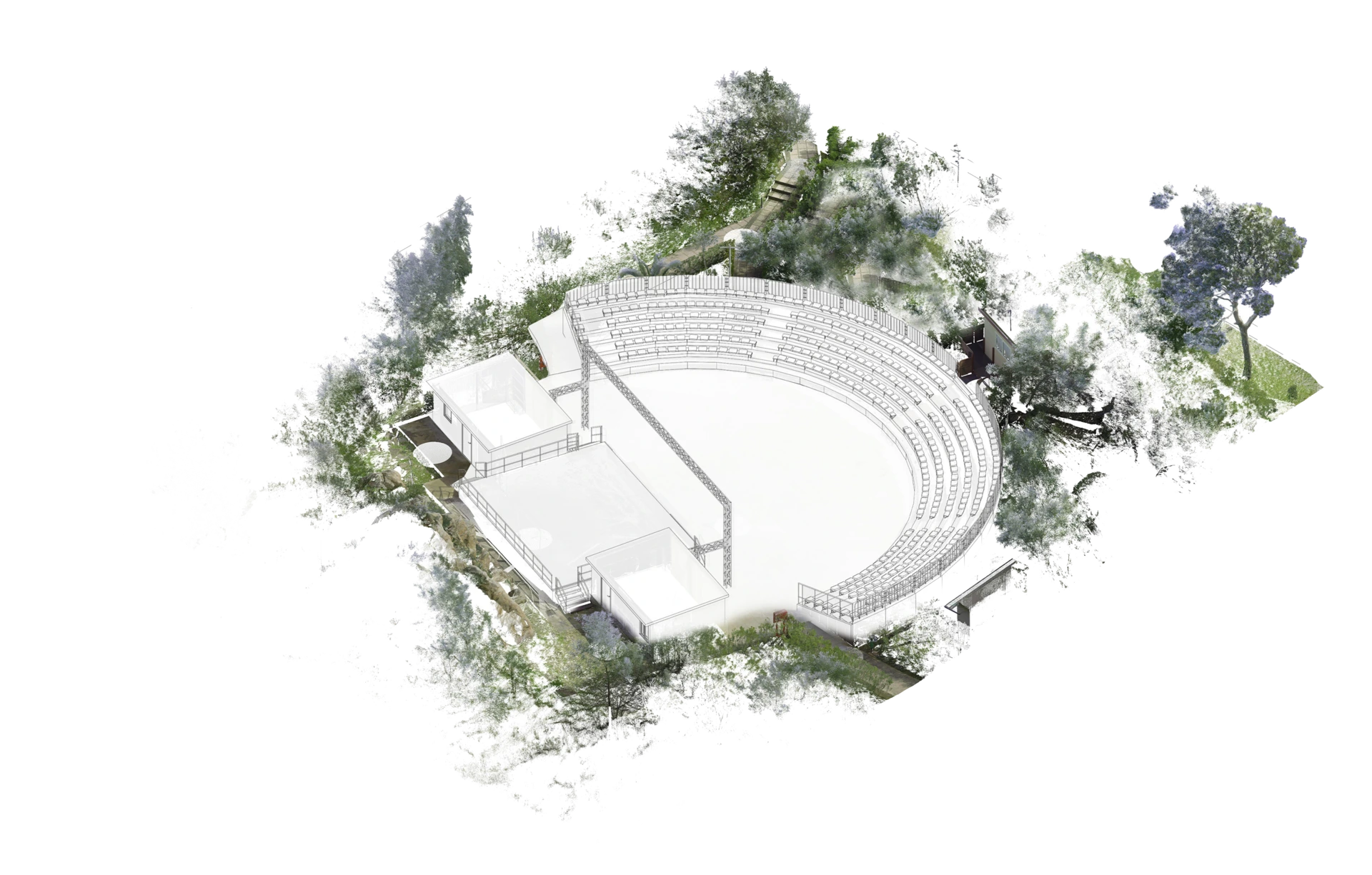
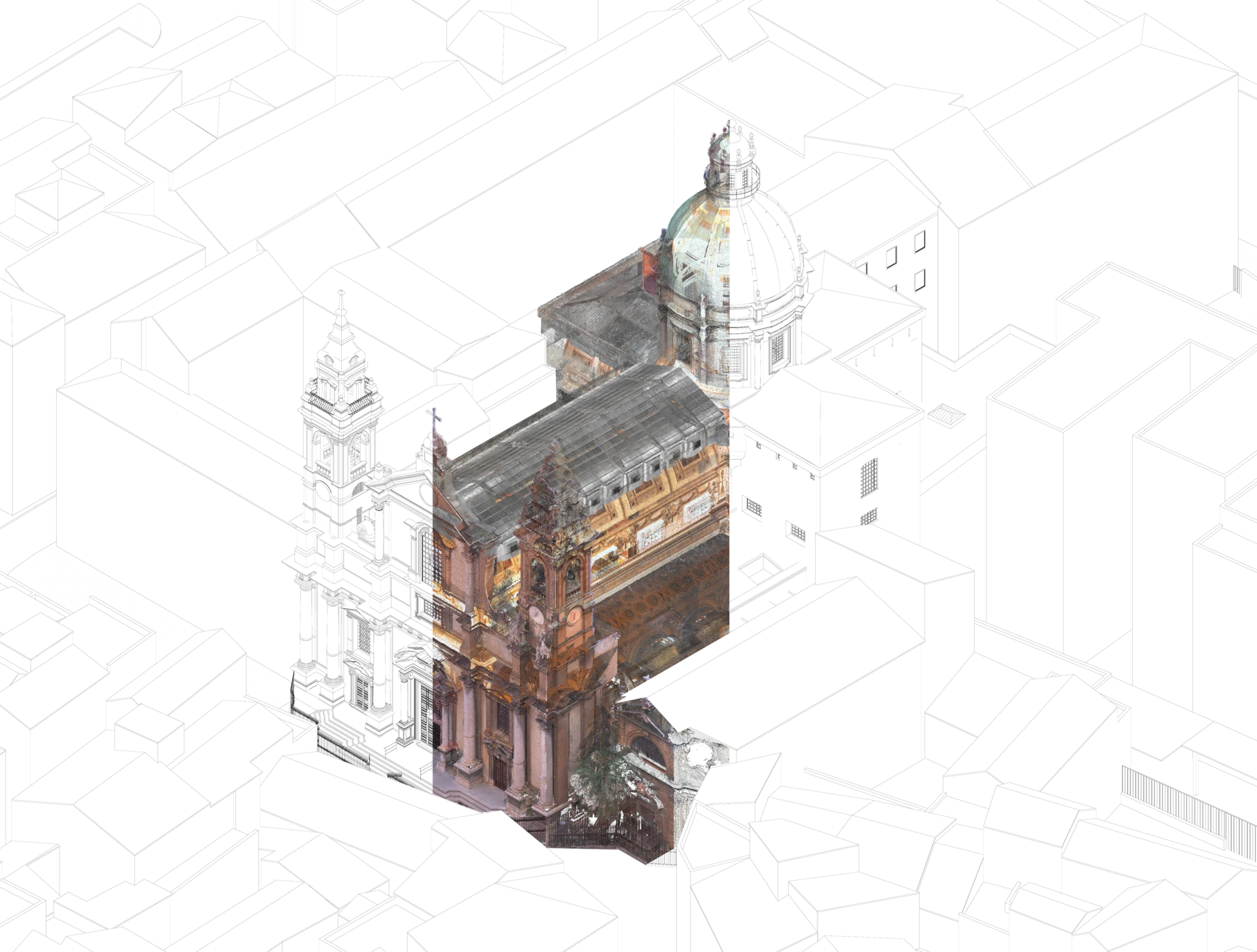
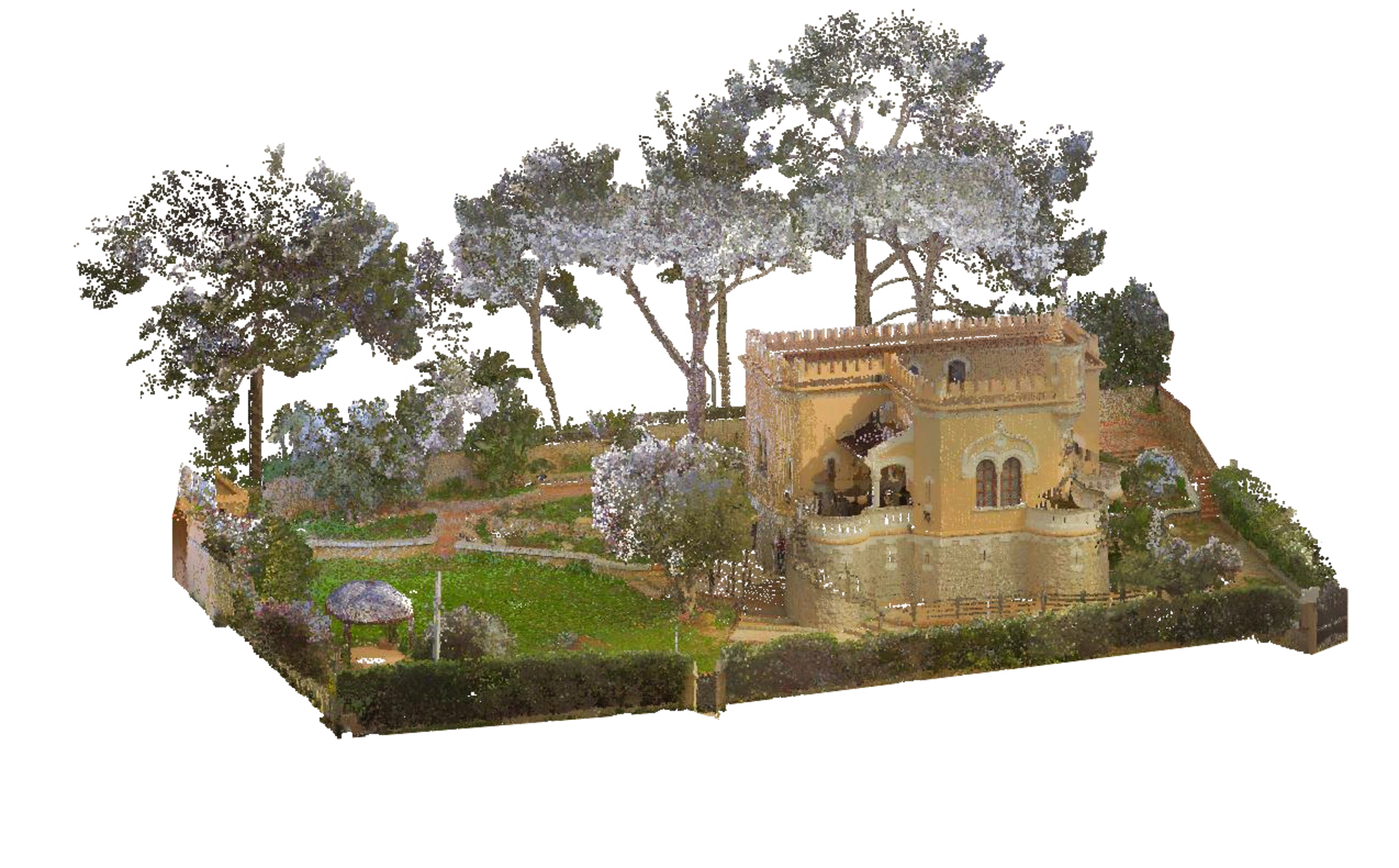
The main product of this process is the "point cloud": a collection of millions of spatial coordinates (X, Y, Z) that define with extreme precision surfaces, contours and three-dimensional geometries of the surveyed object. Each point can be enriched with chromatic information derived from high-resolution photographs, creating a faithful and visually rich three-dimensional representation of reality.
Before practical use in design software, this data requires specialized processing: cleaning from "noise" and interference, density optimization to manage file sizes and computational performance, and organization into logical and manageable sections that facilitate subsequent modeling and analysis phases.
But how do you conduct a digital survey?
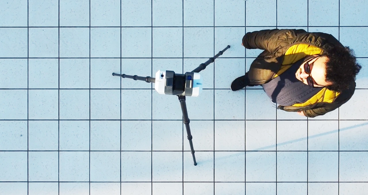
For digital surveys, the two main techniques are photogrammetry and laser scanning (LiDAR). Photogrammetry is a passive method that recreates the 3D model by processing multiple 2D photographs taken from different angles. It's appreciated for contained costs and the richness of chromatic details and textures, but its effectiveness can be limited by lighting conditions and precision may vary.
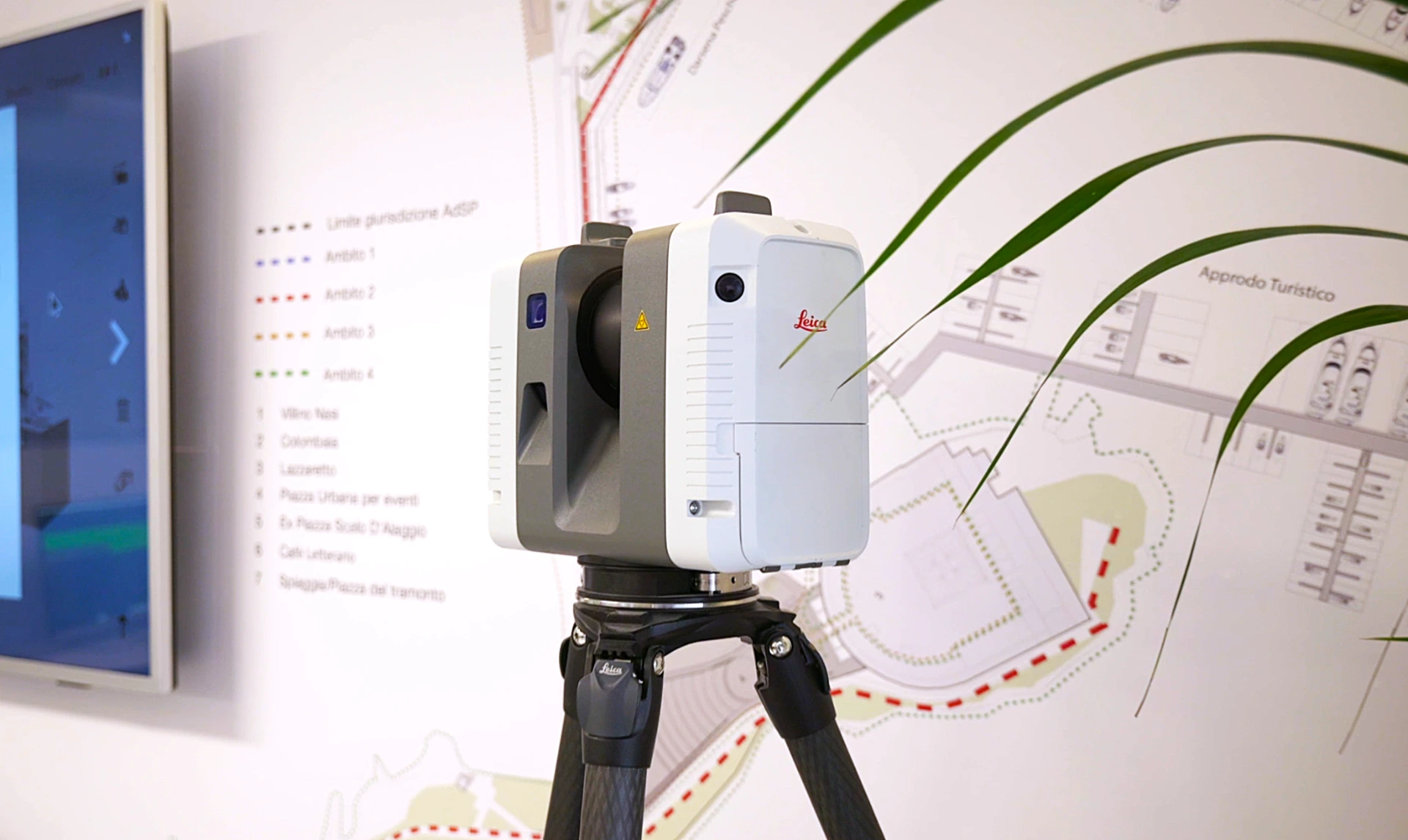
Laser scanning (LiDAR) is instead an active technique that measures distances by emitting laser pulses, generating extremely dense and precise point clouds. It works optimally even in absence of light and can penetrate vegetation, but requires more expensive instrumentation and doesn't intrinsically capture colors.
The choice of survey method is not univocal, but depends on a complex interaction of factors: the dimensional and qualitative characteristics of the object, available budget and required level of precision. Often the two methods are combined to optimize results and costs.
The difference between digital surveying and Scan to BIM
Often these terms are improperly used as synonyms, but they indicate distinct phases of an integrated process that is revolutionizing the approach to built environment documentation.
Digital surveying represents, as we just saw, the data acquisition phase - the systematic "capture" of existing reality through advanced measurement technologies. It's the moment when physical reality is translated into raw digital information.
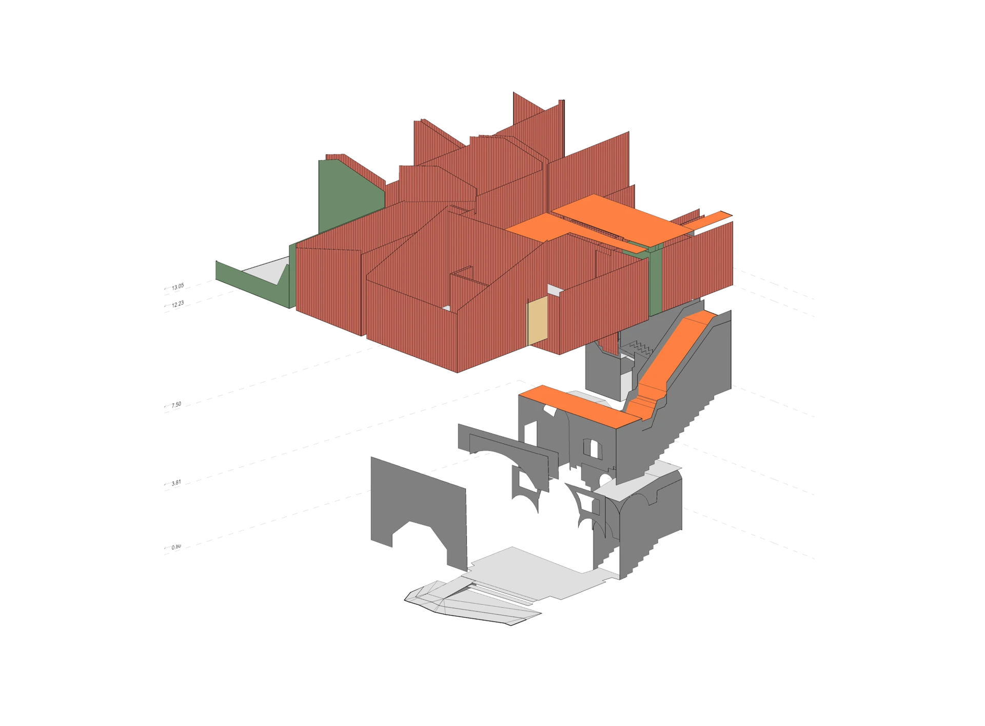
Scan to BIM is instead the subsequent transformation process that converts the point cloud into a structured, parametric and intelligent BIM model. During this phase, raw data is interpreted, organized and enriched with semantic information, creating recognizable construction elements (walls, columns, slabs, systems) equipped with properties and relationships.
The quality and completeness of digital surveying directly influence the accuracy and reliability of the final BIM model. An imprecise or incomplete survey inevitably compromises the quality of the resulting model. Scan to BIM therefore represents the qualitative leap that transforms raw spatial data into a "digital twin" of the building, usable for design, analysis, management and maintenance throughout the entire lifecycle of the work.
This integrated approach is demonstrating significant advantages in professional practice, from reducing design errors to optimizing construction processes. For a complete overview of the economic benefits and specific sectoral applications of Scan to BIM, we refer to the dedicated in-depth study published in DEAL's Journal.
Examples and project case studies (from DEAL portfolio)
DEAL has used these technologies in various contexts:
- Large infrastructures and hospitality complexes From the survey of an important football stadium (for which the laser scanner/drone combination was fundamental for a detailed model, both internal and external) to the Pollina Resort (surveyed with BLK 360 and RTC 360 for a complete and precise BIM model), which demonstrates the ability to manage large-scale projects. And also the survey of Mazara del Vallo, with its inlet and market, greatly benefited from the drone/laser scanner combination for precise design of the wharf and road system.
- Historical heritage and urban redevelopment The survey of Palazzo Favaloro in Palermo, a historic building, allowed for extremely high-precision BIM modeling, down to the smallest facade details. Similarly, the Convento dei Cappuccini in Geraci Siculo, with its vaults and trusses, was surveyed and modeled in BIM for redevelopment and musealization purposes. The former Caserma di Piana degli Albanesi is another example of how laser scanning was crucial for modeling complex geometries like internal vaults.
- From dispute to solution An emblematic case is that of Vicolo Guascone in Palermo, where laser scanner surveying didn't just serve for graphic elaborations, but to resolve a dispute between client and construction company, quantifying with exactness the work performed, demonstrating the strategic value of this data.
- Urban and landscape projects Also the precision in surveying Via Teatro Massimo and Corso Sicilia in Catania through laser scanner and total station allowed detailed planning of road systems and urban furnishings. Similarly, the survey of Villa Allegra in Mondello allowed correct definition of surfaces and elevations for the renovation of external areas, including pool design.
Other examples and case studies can be viewed in the Works section on our website.
A concrete approach for built environment regeneration and the future of design
Digital surveying and Scan to BIM represent a significant evolution in the sector, introducing new possibilities in documentation and management of built heritage. The approach that starts from existing reality rather than theoretical drawings can substantially reduce errors and unexpected issues, proving particularly advantageous for undocumented buildings or those with complex construction history.
Implementation of these technologies can happen through direct investments in equipment and internal staff training, or by relying on specialized consultants who can provide the complete service. The second option allows immediate access to advanced skills and cutting-edge instrumentation without the fixed costs of acquisition and maintenance.
Evaluating the most convenient approach depends on several factors: expected frequency of use, complexity and importance of projects, risks associated with documentation errors, available timeframes and economic resources. Many professional studios find it advantageous to collaborate with sector specialists for specific projects, maintaining operational flexibility.
For projects involving historic buildings, complex infrastructures or when dimensional precision is critical for intervention success, these tools can represent a strategic investment that pays for itself through reduction of costly errors and process optimization. Even for apparently simple buildings, the availability of an accurate digital model can prove valuable in subsequent management and maintenance phases.
If you're interested, don't hesitate to contact us. DEAL Studio offers digital surveying and Scan to BIM services, evaluating together with clients the most suitable approach for each specific project.