For the survey of a historic building in Palermo’s city center, DEAL employed a combined approach using Laser Scanning and drone mapping, with the goal of acquiring a fully georeferenced dataset for subsequent BIM modeling.
Location
Palermo, ItaliaYear
2023Client
MangiasTeam
Giuseppe Prestianni, Carlotta La Pietra, Marco AgriaServices
Scan to BIM, Laser scanner, Drone, Blk360, Leica

The project covered the entire structure, ensuring high accuracy in capturing existing conditions.
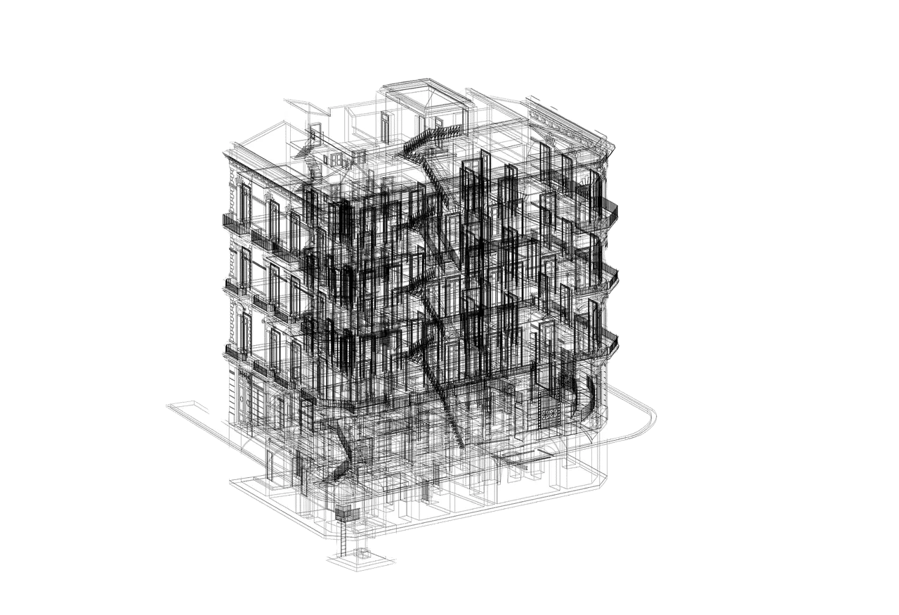
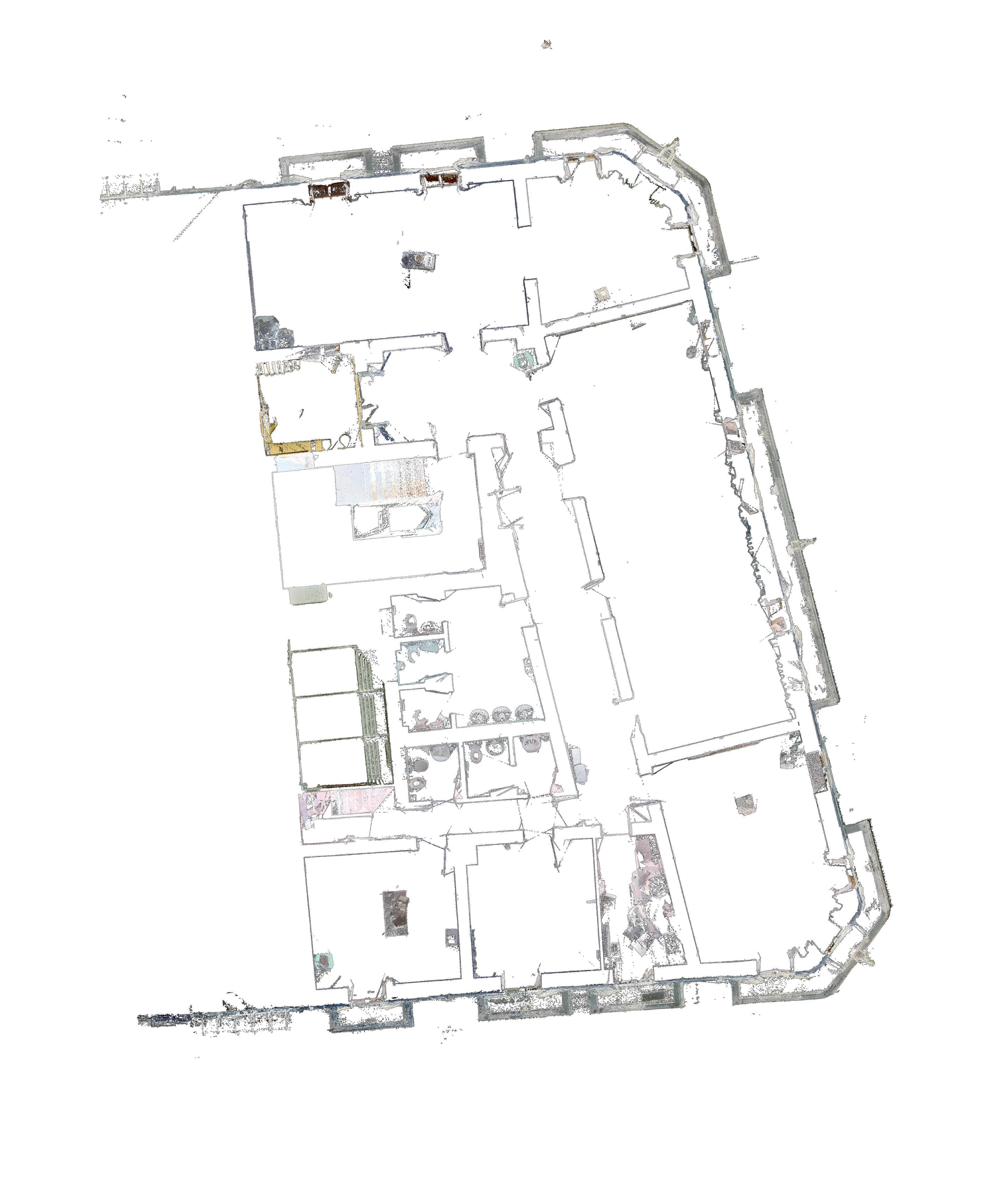
The process involved a meticulous georeferencing phase, carried out with state-of-the-art GNSS equipment, and a high-resolution scan performed with BLK360 to generate a dense point cloud. Aerial data collection, conducted with a DJI Phantom 4 Pro, further enriched the dataset, allowing for the creation of a comprehensive 3D model of the building.
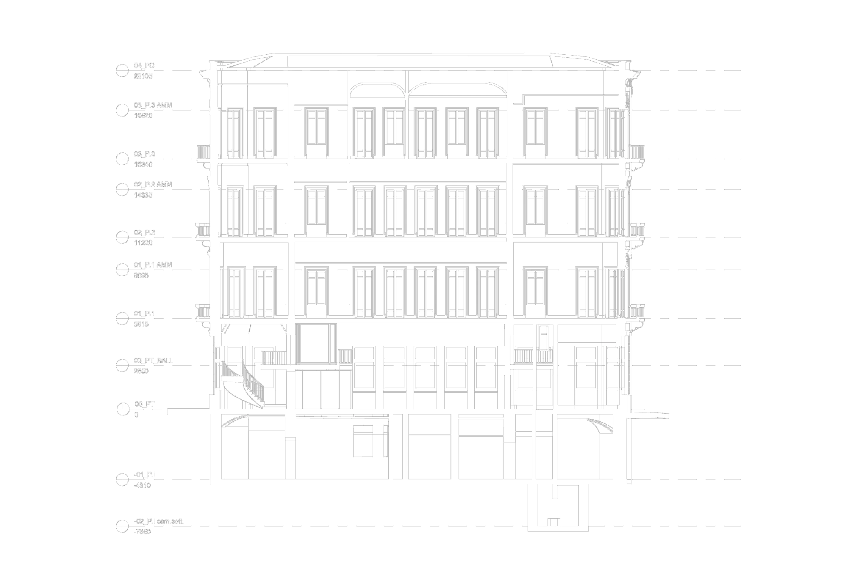
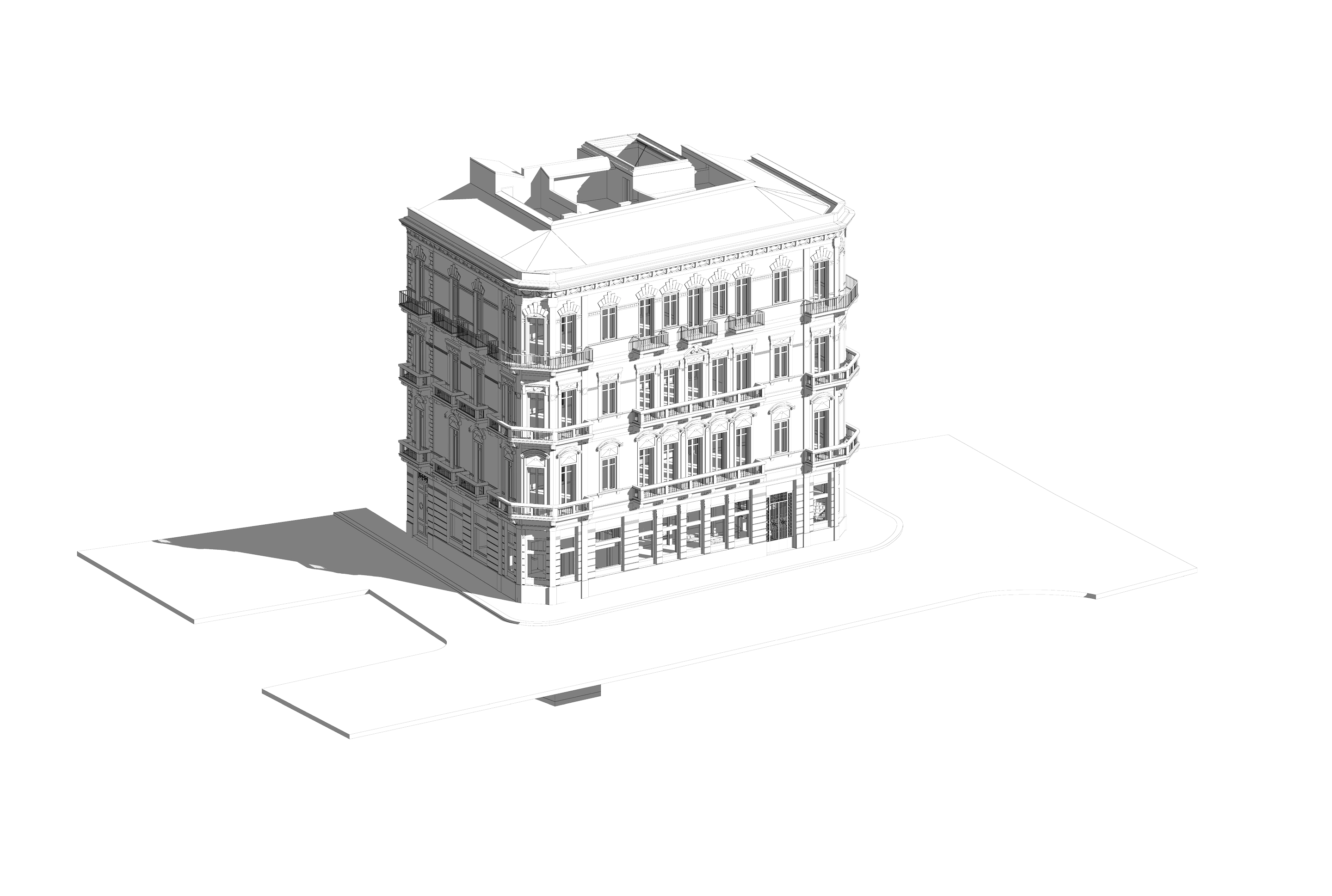
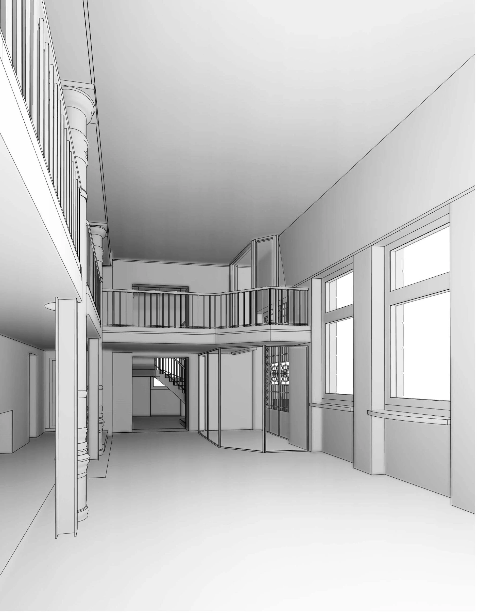
The final survey resulted in a highly detailed point cloud, later used for graphic documentation and photorealistic render production. The acquired data serves as the foundation for the restoration and enhancement of the building.